While driving for a geology field trip, my college professor once told the class that the most common cause of death for geologists is car accidents. This was surely a made-up statistic, but he gave the logical reasoning that while driving, geologist are always looking out the windows and wondering “what the heck is that?!”
With a single drive along I70, locals, visitors and geologists alike can take a look out their window and observe the curious nature of all the mysterious rocks, peaks, and canyons. How did dynamic processes of uplift, faulting, and erosion create landscapes so different and so unique? Much more simply put- what the (blank) is that (and how did it form)?

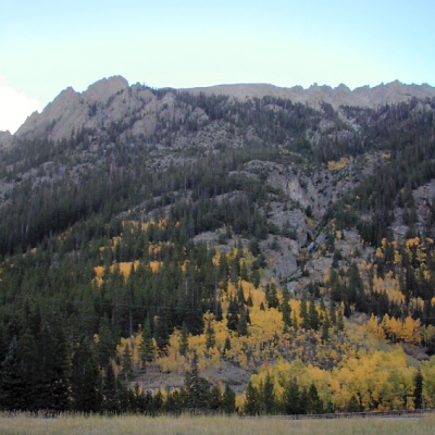
North end of Tenmile Canyon
Exploring the beautiful Eagle County behind my own steering wheel has led me to fully understand my professor’s claim. Many drives I have longed for the shot-gun seat and a top-down convertible to fully take in the surroundings. Between Vail and Frisco, dividing the Gore Range from the Tenmile Range, is Tenmile Canyon. Due to unique geological processes, the stretch of I70 through Tenmile Canyon presents a peculiar, yet jaw-dropping landscape that is quite unique.
The initial uplift of the Rocky Mountains during the Laramide Orogeny created the base of the mountains in Colorado. From this mountain-building event, Gore and Tenmile formed a continuous range. Since then, the ranges have been broken apart by faulting to form a canyon exposing the core of these mountains and the metamorphosed rock.
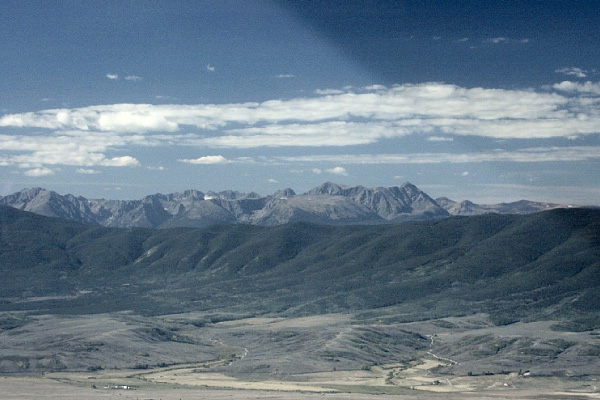
Tenmile Range from Boreas Pass
A fault is a break in between two blocks of land or rock that can move up, down, or sideways. Evidence of this type of action in Tenmile Canyon is not only in the offset of the canyon, but in the polished, lined rocks- called slickensides. Visible along the east wall of the canyon, this feature formed as a result of rock sliding against rock. Some scientists believe that the canyon fault may be an extension of the Mosquito Fault, but little geologic evidence makes drawing conclusions like these difficult
Through your car window, or sitting beside the water at Officer’s Gulch, gazing at the canyon walls, you may see metamorphosed sedimentary (metasedimentary) and metamorphosed igneous (metaignious) rocks, appearing respectively in tight layers or smaller, packed grains. These rocks are evidence of past sediment layers and volcanic flows in the area that have undergone pressure and heat to create the transformed rock in the canyon. Shooting across some parts of the canyon walls are veins of lighter-colored pegmatite, where fractures have allowed for rock to flow and solidify.
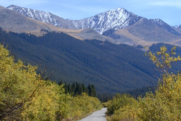
 South end of Tenmile Canyon
From large landscape shaping events to specific features such as the Tenmile Canyon, when it comes to the geologic processes that have shaped the landscape, even the best of scientists may never know the whole story. That does not mean there is not a lot to learn from the stunning geology all around. Hopefully the next time you are driving, or even better, riding as a passenger you will take a closer look at the rocks around you and get one step closer to answering, “what the heck is that!?”
Sources:
http://www.cliffshade.com/colorado/tenmile/#tenmile_canyon
https://glaciers.us/glaciers.research.pdx.edu/Glaciers-Colorado.html
https://coloradoencyclopedia.org/article/glaciers
https://pubs.usgs.gov/bul/1319c/report.pdf
https://usgs.maps.arcgis.com/apps/webappviewer/index.html?id=5a6038b3a1684561a9b0aadf88412fcf
http://www.cliffshade.com/colorado/tenmile/#tenmile_canyon
Carly Innis, a Naturalist at Walking Mountains Science Center, is intrigued by the processes of the earth and how everything, including geology, is interconnected.


