
Trail Name: Mulhall Lakes
Last week found the hiking guides at Walking Mountains Science Center scrambling for a plan B. Our scheduled hike, the ever popular Missouri Lakes Loop, is currently covered in a half mile of avalanche debris from our winter’s historic avalanche cycle. After scouring forest service trail maps, we opted to explore another nearby basin of alpine lakes and discovered a beautiful hike with all the views and none of the crowds: Mulhall Lakes.
Getting There:
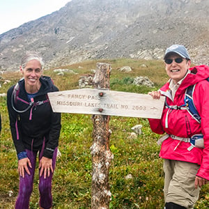
A hike to Mulhall Lakes starts at the Fancy and Missouri Lakes trailhead. Take U.S. Highway 24 through Minturn and toward Leadville. A few miles after you pass Red Cliff, take the Homestake Road on your right. Follow this bumpy but well maintained dirt road 8 miles to a fork in the road, and turn right toward the Missouri Lakes trailhead. Another 3 miles of slightly rougher dirt road will take you to an obvious trailhead.
What to Expect:
A round trip hike to Mulhall Lakes covers about 8 miles and 2,000 feet of elevation gain. Hike 3 miles up the Fancy Lake trail to Fancy Lake. This is a well-maintained trail that climbs a consistent grade to a popular subalpine lake.
From Fancy lake, follow the trail to your right and immediately after crossing the outflow of Fancy Lake take the right fork in the trail towards Holy Cross City. Do not continue up to Fancy Pass.
Follow this trail across two easy water crossings and roughly half a mile to the turnoff toward Mulhall Lakes. The trail to Mulhall Lakes follows an old mining road and is marked on any United States Geological Survey topographic map.
However, the turnoff can be faint and easy to blow by. The trail to the lakes leaves the main trail at the height of land between the first two creeks you cross, and the last outflow creek from Mulhall Lakes.
As the trail enters an opening and just before it drops to the creek, look for the old road on your left, directly adjacent to a large, car-sized boulder. Once you make this turn, the old road is easy to follow all the way to the lakes. You will pass by a smaller lake on your way to the larger upper lake, and a third lake is off the trail, but nearby — bring your map and explore this beautiful basin.
Note on Conditions:
This hike has multiple crossings over small mountain streams. Water levels have dropped significantly in the past few weeks and all these creeks are easily wadeable, but may require getting your shoes a little wet. The first crossing on the Fancy Lake trail requires traversing a large fallen log where a bridge used to be.


